9-10 June 2014
On 9 and 10 June 2014, Dr Peter Leong conducted a workshop on "Maps, Satellites and the Geospatial Revolution" for students of Diploma in Information Technology (
DIT).
Geospatial science, the science of "where", is affecting the way we plan, decide and act in our daily lives. Geospatial Technology is a new and exciting area. IDA’s i-Singapore (Image of Singapore) is one of the key programmes that drives the awareness and adoption of geospatial technology applications in the different industry segments. Interestingly, there is a SINGAPORE GEOSPATIAL SCHOLARSHIP offered by URA in recent years.
The introductory workshop introduced
DIT students to this new and exciting area. Students came eager to find out the technology and knowhow behind the development of apps like Google Maps and Google Earth, where Google has invested billions of dollars in the past few years.

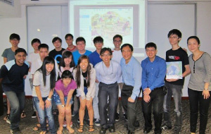
Group photo of
DIT students with guest speakers from URA, Esri and DMIT lecturers
The workshop was also a preview to the Geospatial Visualization free elective in
DIT Year 3. The elective was developed with support with our industry partner, ESRI, the makers of ArcGIS. ESRI Singapore is recognized as an industry expert in the field of spatial intelligence.
As part of the workshop, on 10 June, an external speaker from Urban Redevelopment Authority (URA) Mr Goh Chye Kiang, Senior System Analyst shared with the students on Geographic Information System (GIS) applications used by URA planners such as iPLAN and E-Planner. Mr Goh also shared his personal learning experience in the geospatial field and the future career prospects in this area.
Top